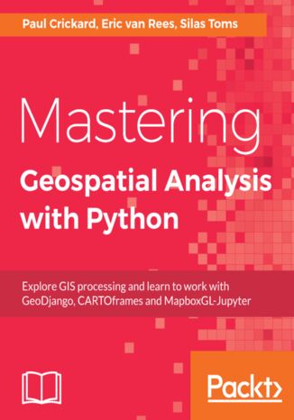
Mastering Geospatial Analysis with Python. Explore GIS processing and learn to work with GeoDjango, CARTOframes and MapboxGL-Jupyter Silas Toms, Paul Crickard, Eric van Rees


- Autorzy:
- Silas Toms, Paul Crickard, Eric van Rees
- Wydawnictwo:
- Packt Publishing
- Ocena:
- Stron:
- 440
- Dostępne formaty:
-
PDFePubMobi
Opis
książki
:
Mastering Geospatial Analysis with Python. Explore GIS processing and learn to work with GeoDjango, CARTOframes and MapboxGL-Jupyter
You will begin by understanding what geoprocessing is and explore the tools and libraries that Python 3 offers. You will then learn to use Python code libraries to read and write geospatial data. You will then learn to perform geospatial queries within databases and learn PyQGIS to automate analysis within the QGIS mapping suite. Moving forward, you will explore the newly released ArcGIS API for Python and ArcGIS Online to perform geospatial analysis and create ArcGIS Online web maps. Further, you will deep dive into Python Geospatial web frameworks and learn to create a geospatial REST API.
Wybrane bestsellery
Silas Toms, Paul Crickard, Eric van Rees - pozostałe książki
Packt Publishing - inne książki
Dzięki opcji "Druk na żądanie" do sprzedaży wracają tytuły Grupy Helion, które cieszyły sie dużym zainteresowaniem, a których nakład został wyprzedany.
Dla naszych Czytelników wydrukowaliśmy dodatkową pulę egzemplarzy w technice druku cyfrowego.
Co powinieneś wiedzieć o usłudze "Druk na żądanie":
- usługa obejmuje tylko widoczną poniżej listę tytułów, którą na bieżąco aktualizujemy;
- cena książki może być wyższa od początkowej ceny detalicznej, co jest spowodowane kosztami druku cyfrowego (wyższymi niż koszty tradycyjnego druku offsetowego). Obowiązująca cena jest zawsze podawana na stronie WWW książki;
- zawartość książki wraz z dodatkami (płyta CD, DVD) odpowiada jej pierwotnemu wydaniu i jest w pełni komplementarna;
- usługa nie obejmuje książek w kolorze.
Masz pytanie o konkretny tytuł? Napisz do nas: sklep@helion.pl
Książka drukowana









Oceny i opinie klientów: Mastering Geospatial Analysis with Python. Explore GIS processing and learn to work with GeoDjango, CARTOframes and MapboxGL-Jupyter Silas Toms, Paul Crickard, Eric van Rees
(0)